
Most international borders are designed to make the transition between countries feel orderly and unmistakable. Then there are the places where the boundary runs through a building, sits in the middle of a lake, requires driving through another country just to get home, or can be crossed on a zip line. Some are major transportation corridors, while others barely resemble border crossings at all. These 15 places make simply entering another country part of the experience.
1. Baarle, Belgium and the Netherlands
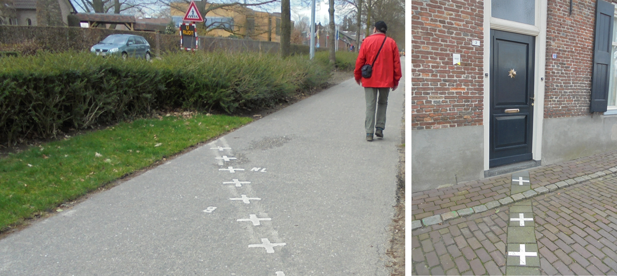
Walking around Baarle can mean crossing an international border repeatedly without even reaching the end of the street. The town is divided between the Belgian municipality of Baarle-Hertog and the Dutch municipality of Baarle-Nassau, with 30 interlocking enclaves between them. Border markings run across roads, gardens, shops, and even individual houses, and some buildings are literally split between the two countries. The nationality of a building is generally determined by where its front door sits, which makes an ordinary walk through town feel like someone turned a political map into a maze.
2. Gibraltar’s Runway Crossing
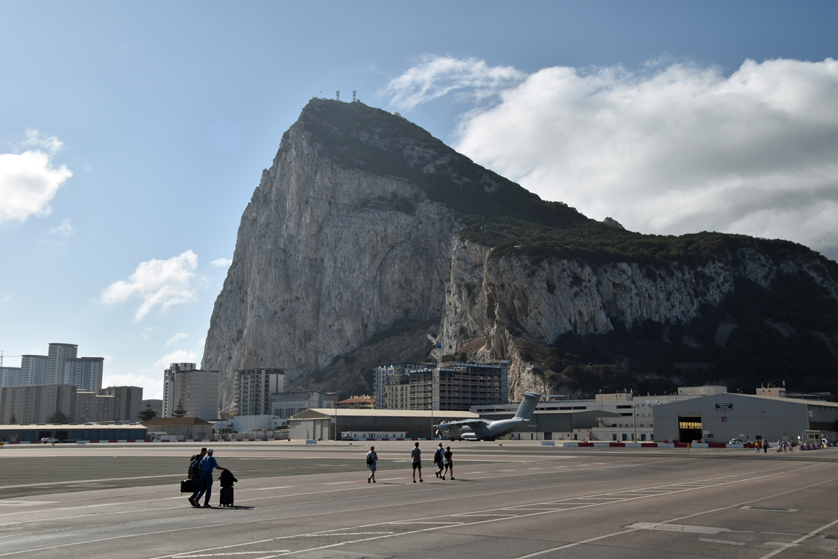
Visitors entering Gibraltar on foot from Spain can encounter something that looks more like an airport safety exercise than a border experience. The pedestrian route into Gibraltar crosses the active runway of Gibraltar International Airport, and barriers close when aircraft are taking off or landing. Once they reopen, people simply walk across the tarmac and continue toward town. Gibraltar tourism authorities even publish instructions specifically for people crossing the runway safely.
3. The Haskell Free Library, Canada and the United States
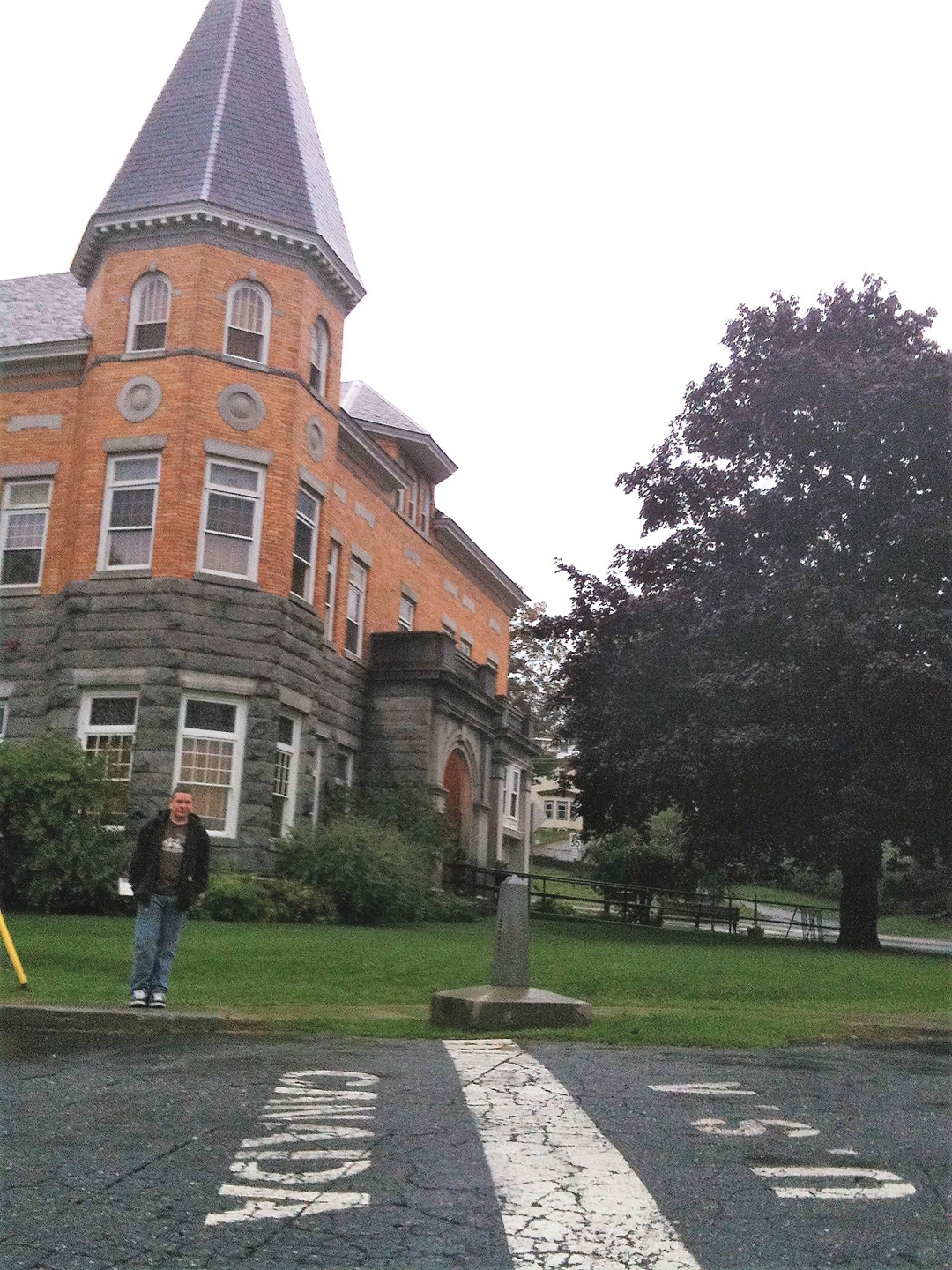
The international boundary between Quebec and Vermont passes directly through the Haskell Free Library and Opera House. The building was deliberately constructed on the border so people from both countries could use it, creating rooms where Canada and the United States are separated by little more than a line across the floor. For years, Canadians could approach the American entrance under a special arrangement, but that changed in 2025. A new Canadian entrance opened in June 2026, allowing visitors from Stanstead to enter without first passing through a U.S. checkpoint.
4. Attari-Wagah, India and Pakistan
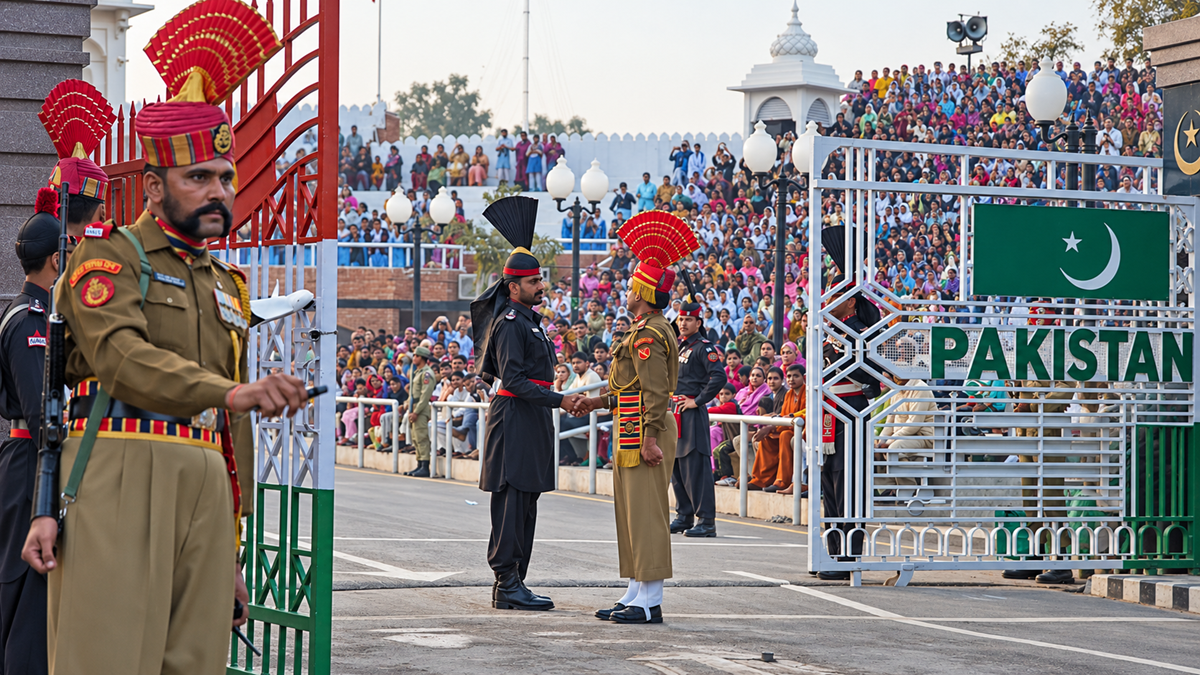
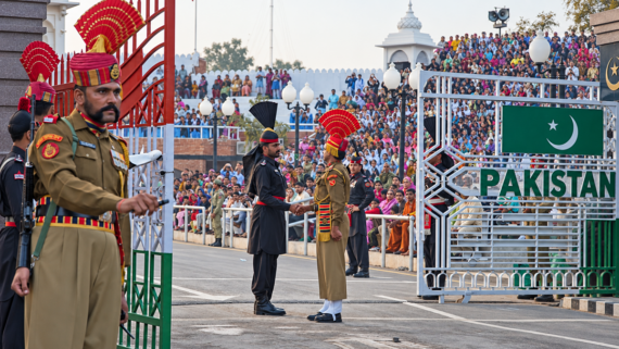
At most borders, closing time is uneventful. At Attari-Wagah, it can draw a crowd. Indian Border Security Force personnel and Pakistan Rangers perform a highly choreographed flag-lowering ceremony with synchronized marching, sharp gestures, and spectators cheering from grandstands on both sides. The crossing has become so closely associated with the daily ritual that watching the border close is itself a major visitor attraction near Amritsar.
5. Khunjerab Pass, Pakistan and China
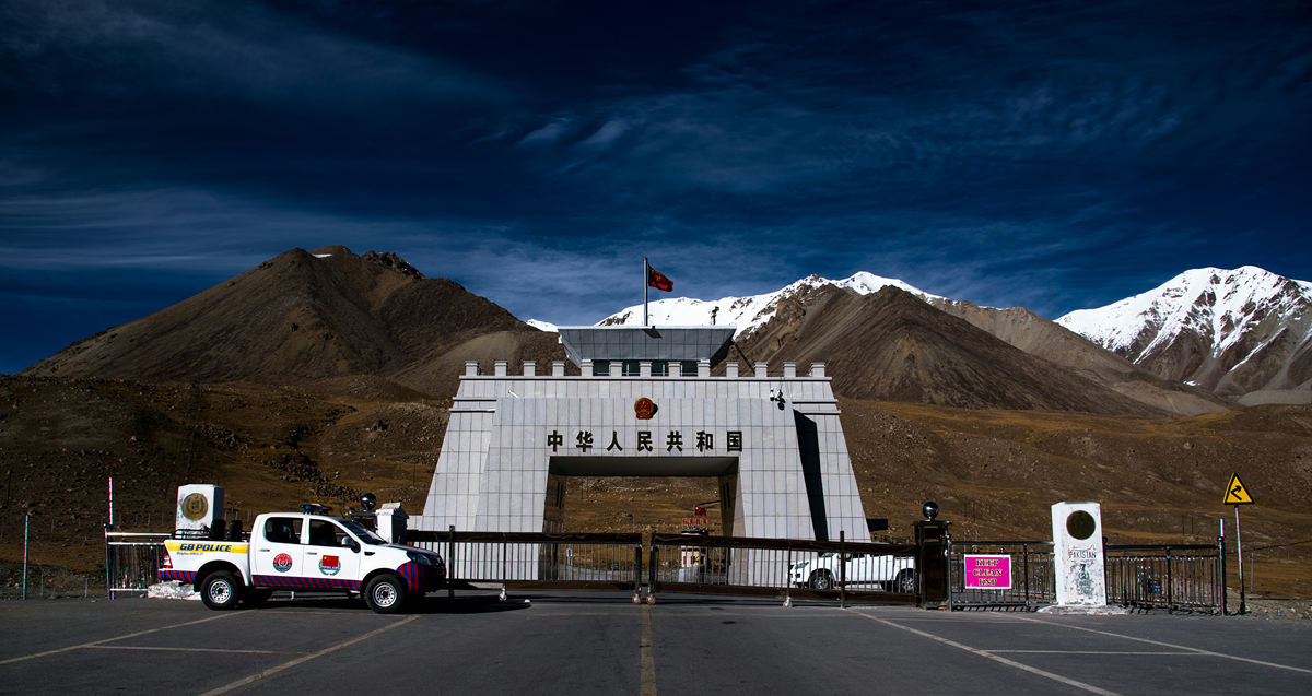
Immigration formalities feel very different at nearly 4,700 meters above sea level. Khunjerab Pass, on the Karakoram Highway between Pakistan and China, is widely described by Pakistani authorities as the highest paved international border crossing in the world. Snowy mountains and enormous open landscapes surround the road, making the checkpoint look surprisingly small against the terrain. Getting to the border is already a substantial mountain journey before anyone produces a passport.
Trending on The Scroller


6. The Three-Country Cairn, Finland, Sweden and Norway
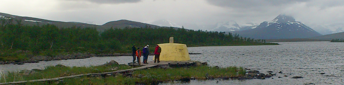
There are no immigration booths surrounding this border marker in Arctic Lapland. Instead, visitors reach a concrete cairn where Finland, Sweden, and Norway meet, then walk around it to step through three countries in a matter of seconds. The marker sits in water and has a wooden walkway around it, while summer visitors can hike there and winter travelers can cross the frozen landscape. It is the northernmost international tripoint in the world.
7. Kazungula Bridge, Botswana and Zambia
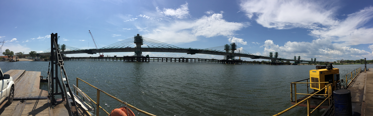
Kazungula already occupies one of the strangest pieces of border geography in Africa. Botswana and Zambia meet along the Zambezi close to the borders of Namibia and Zimbabwe, putting four countries within a remarkably small area. The Kazungula Bridge, opened in 2021, replaced the old ferry connection with a road and rail crossing and one-stop border facilities. Even before reaching immigration, travelers are surrounded by a mapmaker’s headache.
8. Peace Arch, Canada and the United States
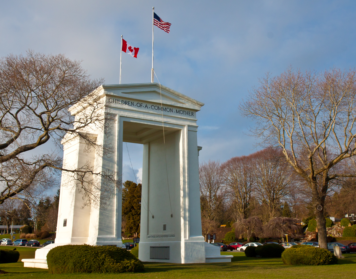
Between British Columbia and Washington, the boundary passes through landscaped parkland rather than an intimidating wall. The Peace Arch itself stands directly on the international line, with Canadian and American parkland meeting around it. Visitors still need to obey immigration rules if they actually enter the other country, and authorities can request identification, but the park gives the border an unusually open physical appearance. The arch has stood there since 1921.
Sign up for our newsletter
9. Cristo Redentor, Argentina and Chile
The drive from Mendoza toward Chile gradually turns an ordinary international journey into a high-altitude expedition. The Cristo Redentor, or Los Libertadores, crossing sits above 3,000 meters in the Andes and carries travelers through a tunnel beneath the mountain border. On the Chilean side, the approach is famous for its tight switchbacks descending toward Los Andes. Winter snow can close or restrict the route, so crossing the frontier here is partly dependent on what the mountains decide to do that day.
10. Point Roberts, United States and Canada
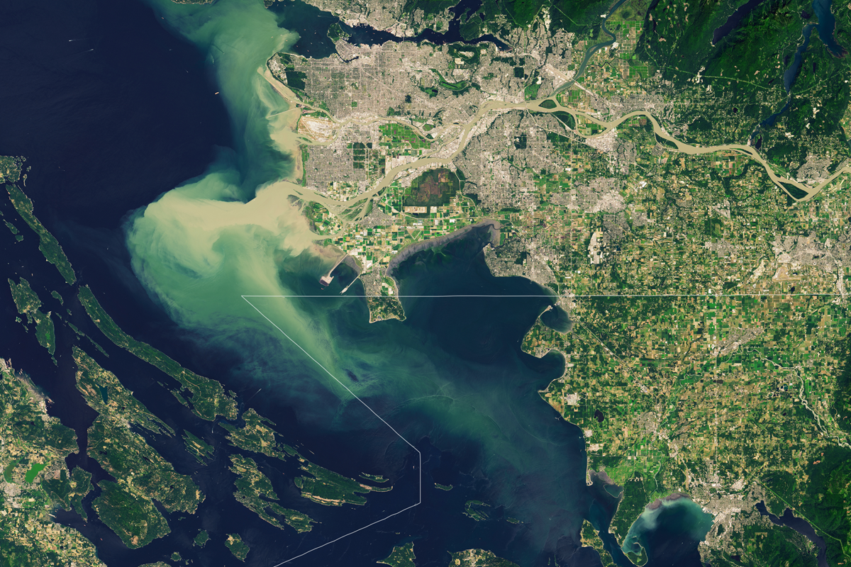
Point Roberts is American territory, but driving there from the rest of Washington requires entering Canada first. The small Washington community occupies the southern tip of a peninsula below the 49th parallel and is cut off by land from the rest of the United States. A resident driving to mainland Washington therefore crosses from the U.S. into Canada and later crosses back into the U.S. again. What looks like a quiet suburban border post is really the entrance to one of North America’s strangest geographic leftovers.
11. Límite Zero, Spain and Portugal
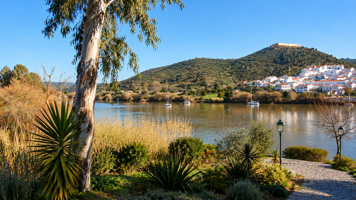
This is probably the only border on the list where the recommended method of crossing involves a harness and a cable. Límite Zero operates a 720-meter zip line from Sanlúcar de Guadiana in Spain across the Guadiana River to Alcoutim in Portugal. Because Portugal is one hour behind neighboring Spain, riders technically arrive in another country at an earlier local time than when they started. Border travel rarely makes time zones feel quite this literal.
12. Victoria Falls Bridge, Zambia and Zimbabwe
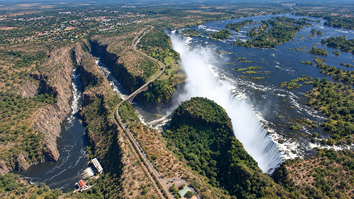
Few border crossings come with this much background noise. The Victoria Falls Bridge carries road, rail, and pedestrian traffic across the Zambezi between Zambia and Zimbabwe, with the gorge and enormous spray of Victoria Falls nearby. The bridge itself sits between the two border posts, creating a stretch of international transit where travelers can stop and look down into the gorge. It also hosts a commercial bungee jump, meaning some people reach the middle of the frontier and deliberately throw themselves off the bridge.
13. Torkham, Pakistan and Afghanistan
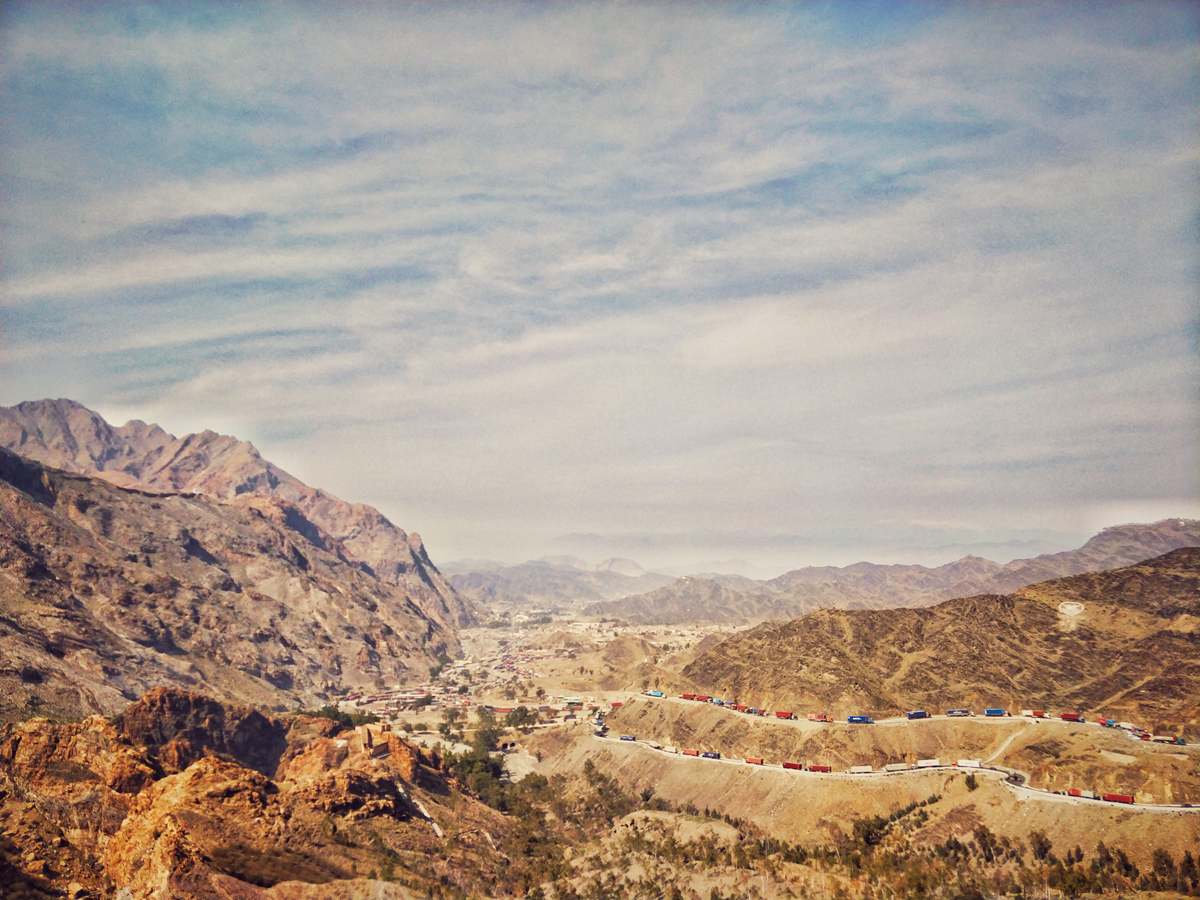
Torkham is one of the busiest and most intense crossings between Pakistan and Afghanistan, squeezed into a steep mountain corridor near the Khyber Pass. Trucks, buses, pedestrians, security barriers, and rugged cliffs all converge in a narrow strip of road, giving the border a compressed, almost chaotic visual character. Unlike crossings built across flat open land, Torkham feels hemmed in by the landscape itself, with the mountains turning the frontier into a dramatic gateway. Even in photographs, it looks less like a conventional checkpoint and more like a passage forced through the terrain.
14. Ceuta and Morocco
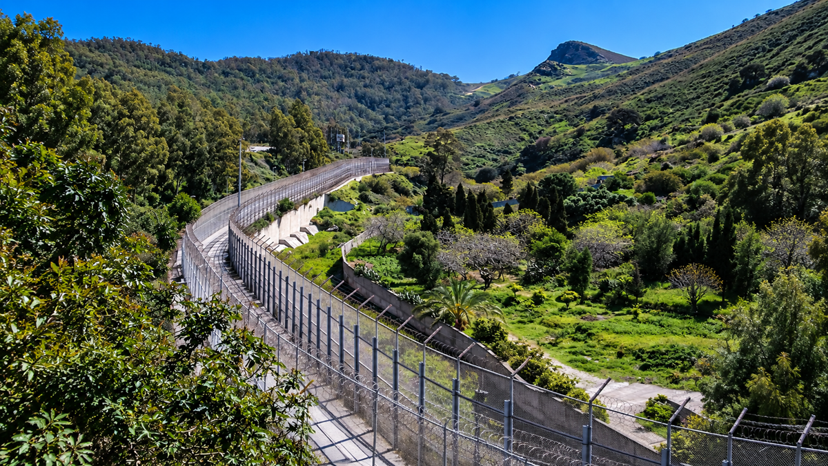
Crossing between Morocco and Ceuta means moving between Africa and Spanish territory without leaving the continent. Ceuta is part of Spain and therefore creates one of the European Union’s few land frontiers with Africa. Its border system is also unusual because travelers entering Ceuta encounter one control at the Moroccan frontier, while travel onward from Ceuta to mainland Spain involves an additional Schengen control. Geography and immigration rules overlap here in ways that make the short distance across the boundary unusually complicated.
15. Diomede Islands, United States and Russia

In the Bering Strait, Little Diomede belongs to the United States and Big Diomede belongs to Russia, with only a few kilometers of water between them. The international border and the International Date Line run through the narrow gap, so the two islands are often described as being almost a day apart despite sitting within sight of each other. In winter, sea ice can make the separation look even stranger, with two countries appearing almost close enough to walk between. It is less a conventional checkpoint than one of the most visually surreal borders on Earth.
In the mood for more?
Check out 15 Travel Destinations That Used to Be Completely Off-Limits to Tourists, or take a look at 15 Overlooked Countries That Surprise Almost Everyone Who Visits. If you want to see more unusual travel facts, you can check out 16 Countries That Surprise Americans With How Differently Everyday Life Works.