
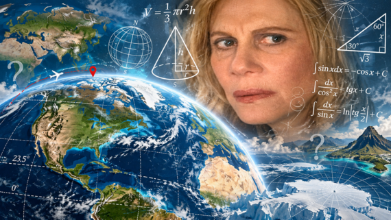
Maps are good at making the planet understandable, but they also train us to picture it in ways that are not quite accurate. Continents sit farther north, east, or west than many people assume, while familiar map projections can make enormous places look oddly small. Even simple ideas like east, west, and the shortest route between two cities get stranger on a globe. These 15 geographic facts are accurate, even when they initially sound like someone drew the map wrong.
1. Most of South America Is East of Florida
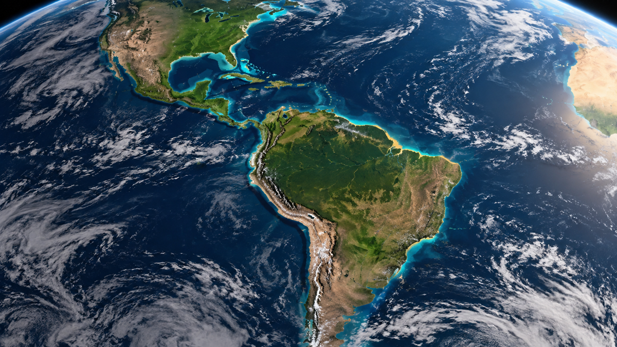
South America looks as though it should sit directly below North America, but the continent angles much farther east than most mental maps suggest. In fact, virtually all of South America lies east of Florida. The western coast of South America reaches into roughly the same longitudes as parts of the eastern United States, while Brazil projects deep into the Atlantic.
2. Paris Is Farther North Than Montreal
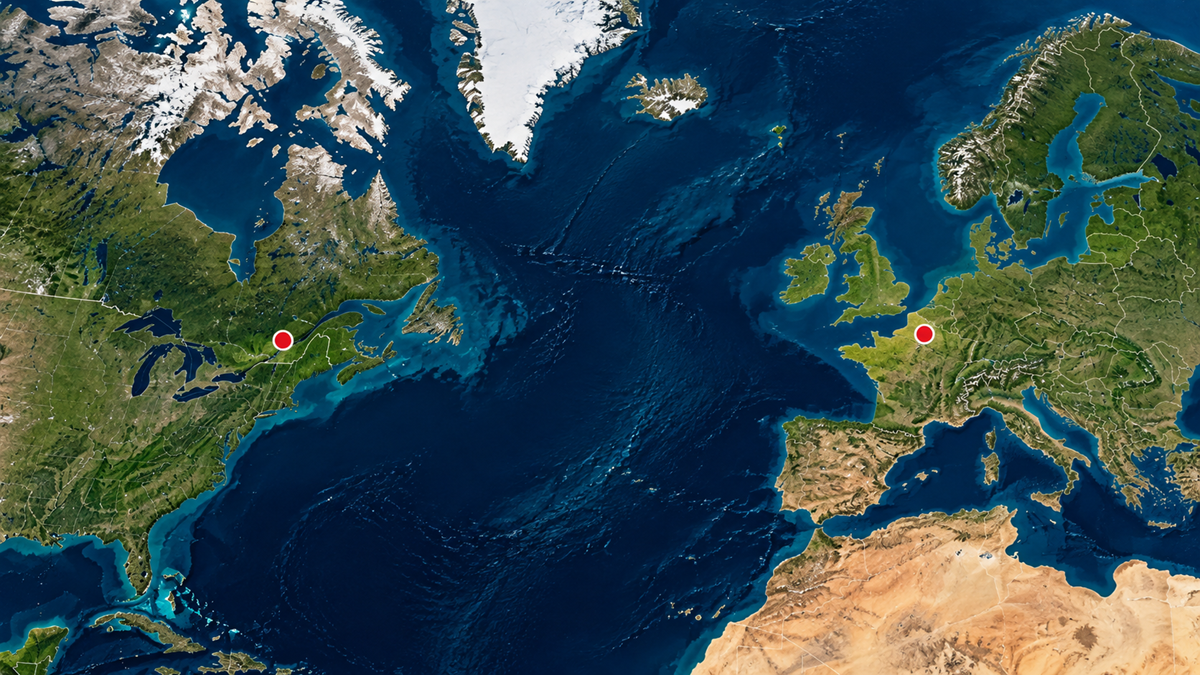
Climate makes this one particularly difficult to picture. Paris sits at about 49 degrees north, while Montreal is near 45 degrees north, meaning the French capital is noticeably farther toward the North Pole. Western Europe’s relatively mild weather makes many cities there feel geographically aligned with the United States when they actually line up more closely with Canada.
3. Alaska Is Both the Westernmost and Easternmost U.S. State
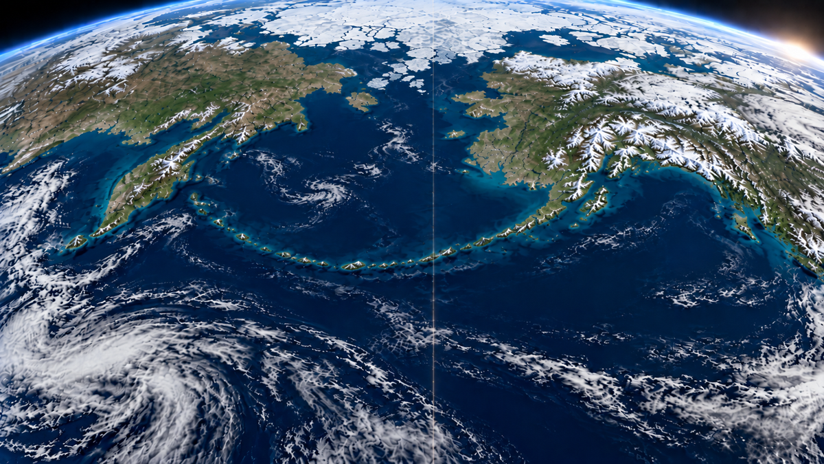
Alaska obviously reaches farther west than any other American state, but technically it also reaches farther east. The Aleutian Islands cross the 180th meridian, where western longitudes become eastern longitudes. Semisopochnoi Island reaches about 179°46′ east, giving Alaska the country’s easternmost longitude as well as its westernmost one.
4. South America Is More Than Eight Times the Size of Greenland
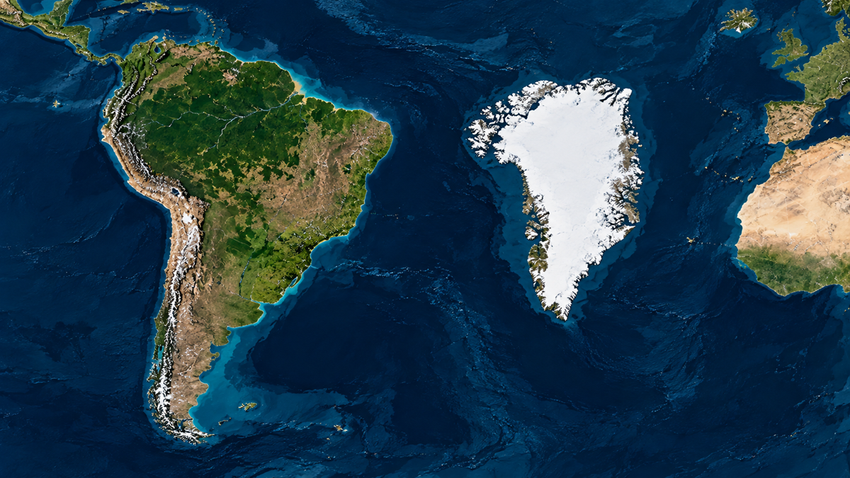
On a Mercator map, Greenland can look enormous, sometimes nearly comparable to South America. The real proportions are nowhere close. South America covers more than eight times Greenland’s area, a difference hidden by the way Mercator projections increasingly enlarge places as they approach the poles.
5. Africa Is the Only Continent in All Four Hemispheres
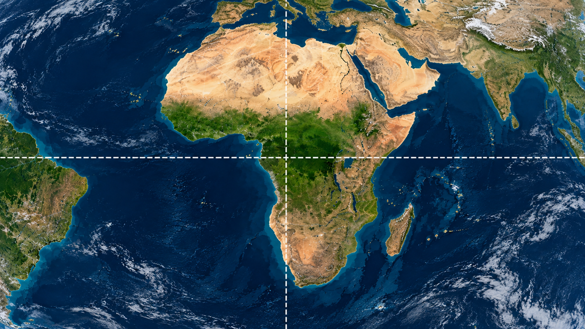
Africa is crossed by both the Equator and the Prime Meridian, which puts parts of the continent in the Northern, Southern, Eastern, and Western Hemispheres. No other continent occupies all four. It is one of those basic map facts that feels obvious only after someone points it out.
Trending on The Scroller

6. Brazil Is Larger Than the Contiguous United States
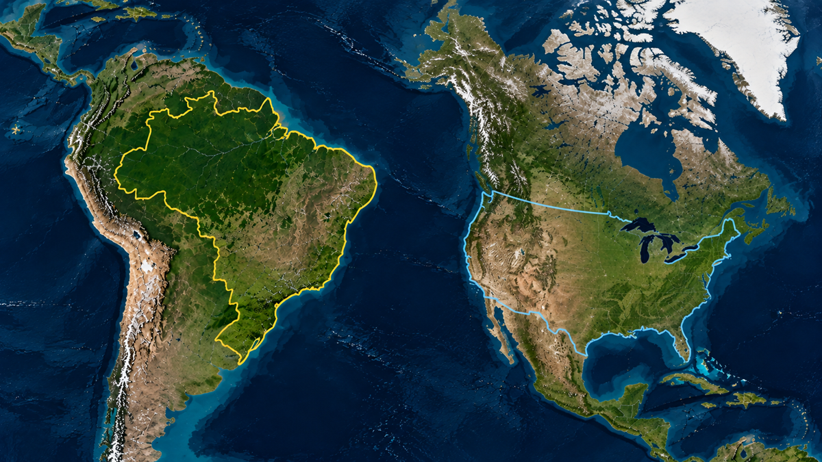
Brazil often looks less imposing on world maps than the United States, especially on projections that exaggerate northern latitudes. In actual area, Brazil is larger than the 48 contiguous U.S. states combined. It is also nearly as large as Canada, despite appearing dramatically smaller on many familiar classroom maps.
7. Alaska Is Smaller Than Libya
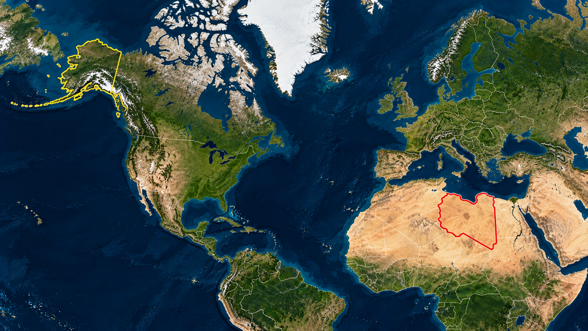
Mercator maps do Alaska plenty of favors. Its high latitude stretches the state until it can look comparable to some of the world’s largest countries, but Libya actually covers more area. Alaska remains enormous by U.S. standards, just not quite as enormous as its position near the top of a flat map makes it seem.
8. The Pacific Ocean Is Wider Than the Moon
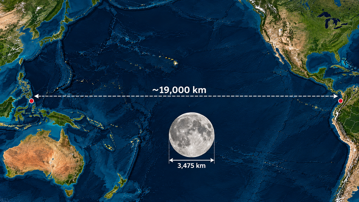
At its broadest, the Pacific Ocean spans roughly 19,000 kilometers from Indonesia to Colombia. The Moon’s diameter is only about 3,475 kilometers, so the Pacific is more than five times wider than the Moon itself.
Sign up for our newsletter
9. The International Date Line Is Not a Straight Line
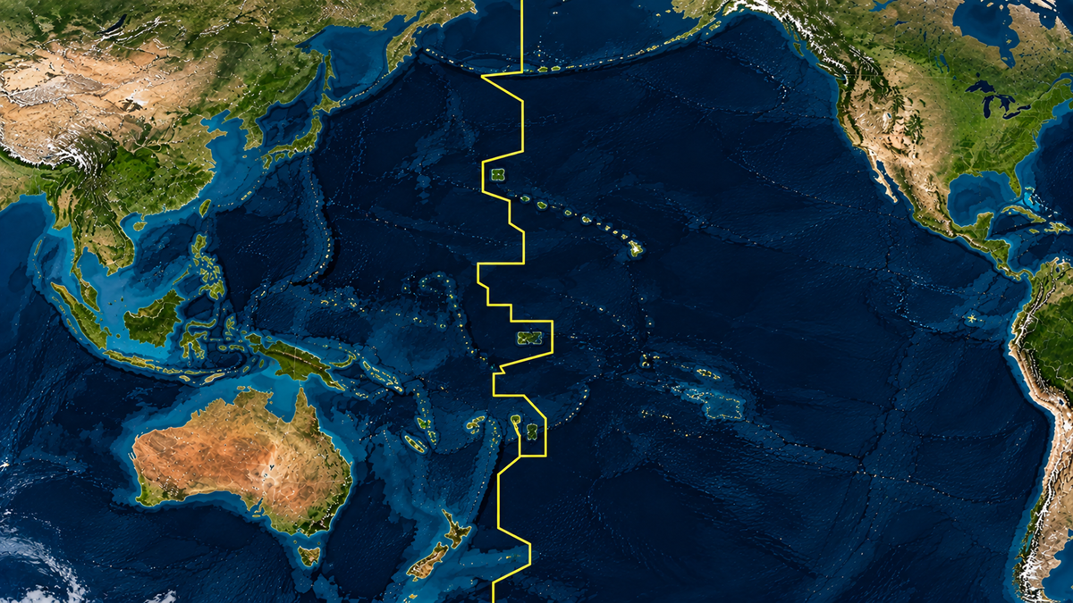
The name makes it sound like a clean geographic boundary following the 180th meridian. Instead, the International Date Line zigzags across the Pacific to avoid cutting countries and island groups into different calendar days. It does not even have international legal status, and governments can decide which dates their territories observe.
10. Antarctica Is a Desert
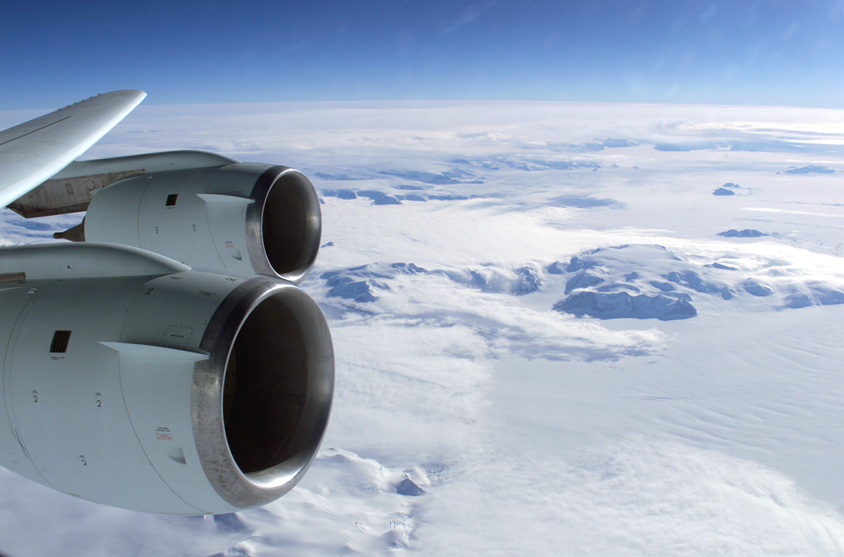
Deserts are defined by how little precipitation they receive, not by how hot they are. Antarctica qualifies as a polar desert, with much of its interior receiving extremely little precipitation each year despite being covered in ice.
11. Longitude Shrinks to Zero at the Poles, Where Every Time Zone Meets
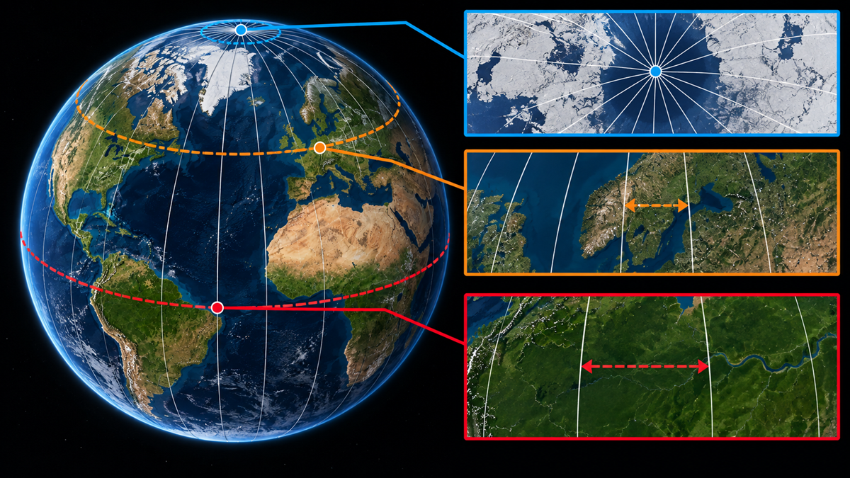
A degree of longitude spans about 111 kilometers at the equator, but that distance gets smaller as you move toward either pole. At the North and South Poles, all lines of longitude converge at a single point, so the distance between them effectively becomes zero. Because time zones are based largely on longitude, every time zone also meets there, meaning every hour of the clock can technically be represented at the same physical location.
12. The Shortest Route Can Look Completely Wrong on a Flat Map
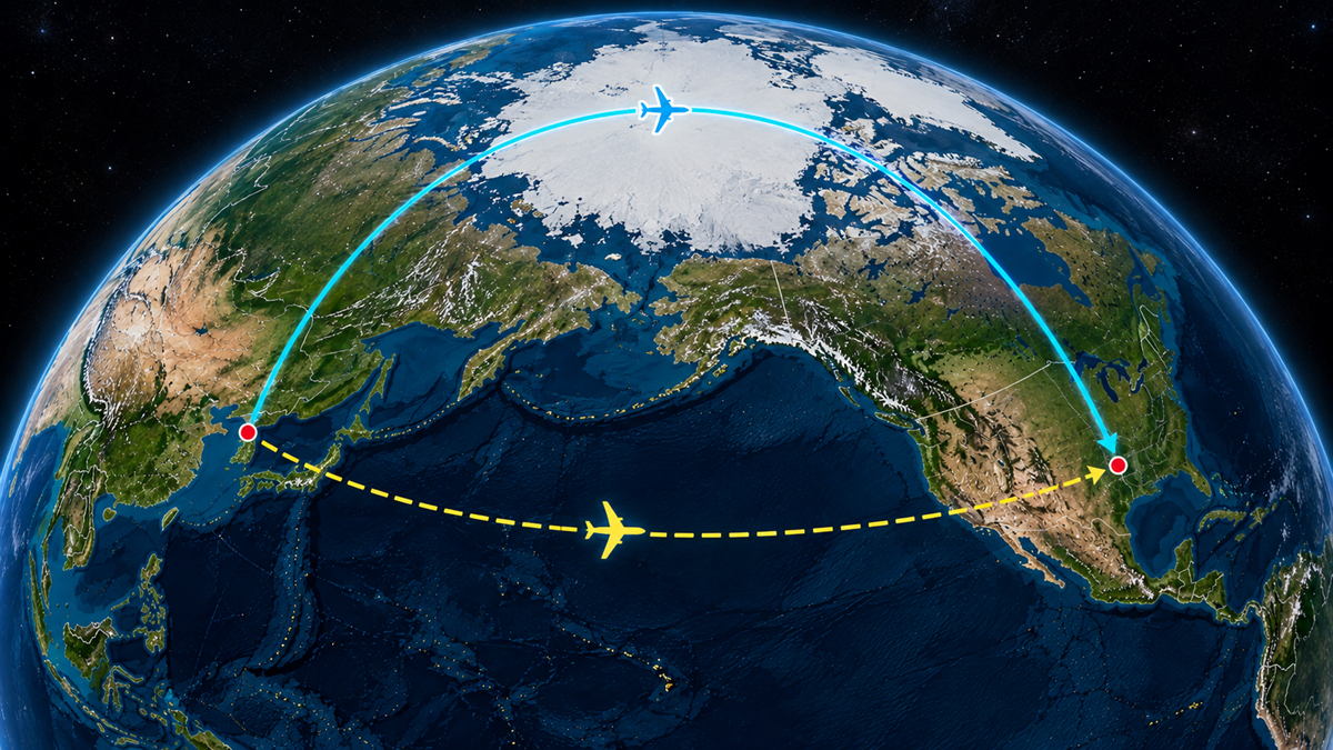
Draw a route between North America and East Asia on a rectangular map and heading across the Pacific may appear most direct. On a globe, great-circle routes can curve dramatically toward the Arctic instead. That is why routes that seem like enormous detours on a wall map can actually cover less distance.
13. North America and Africa Were Once Connected
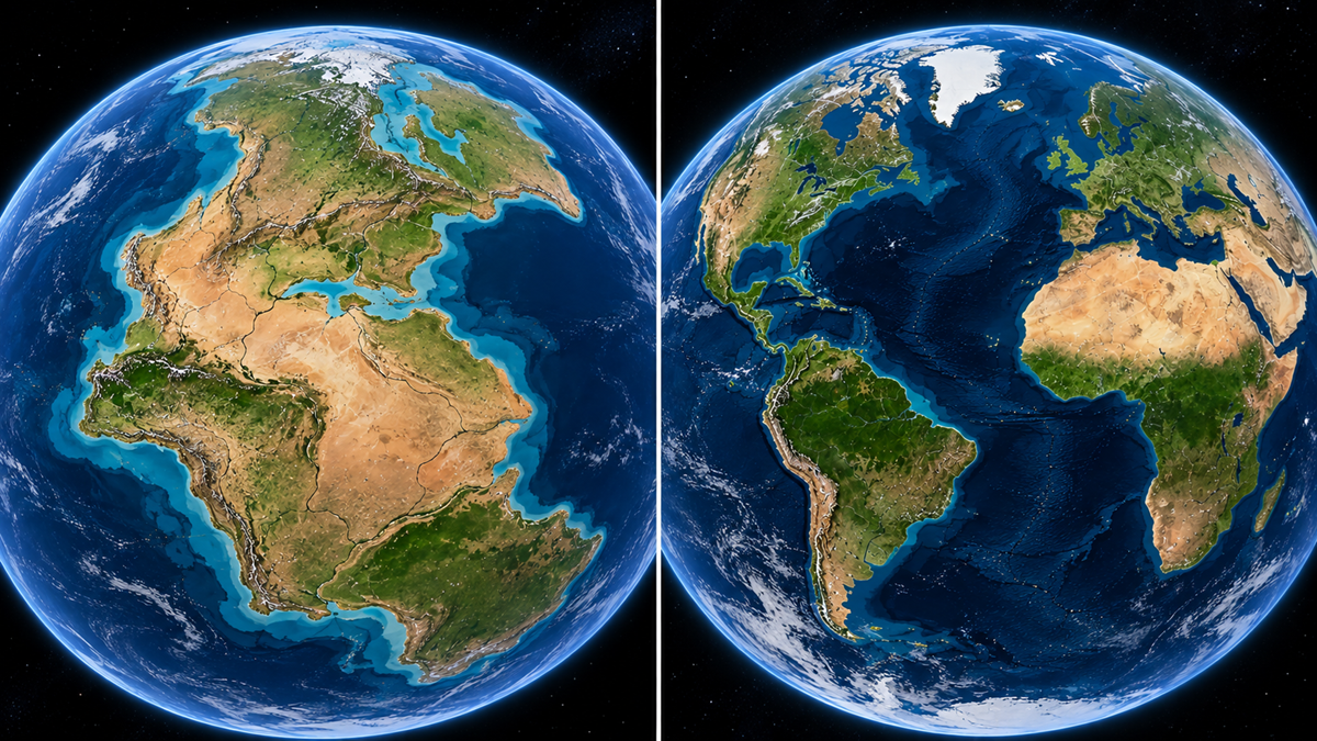
Today’s Atlantic makes the continents feel permanently separated, but roughly 300 to 200 million years ago North America was joined with Africa, South America, and Europe as part of Pangea. Rifting gradually pulled the landmasses apart and opened the Atlantic Ocean between them. The coastlines visible today are a temporary arrangement on the geological timescale.
14. The Atlantic Ocean Is Still Getting Wider
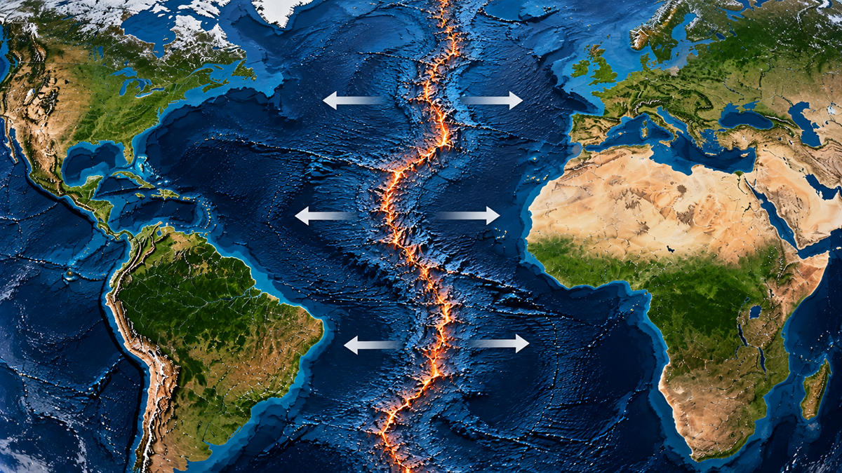
The breakup of Pangea never really stopped. New crust continues to form along the Mid-Atlantic Ridge as tectonic plates move apart, gradually widening the Atlantic basin. On a human timescale, the change is almost invisible, but over millions of years it can completely rearrange the map.
15. Mount Chimborazo Is Farther From Earth’s Center Than Everest
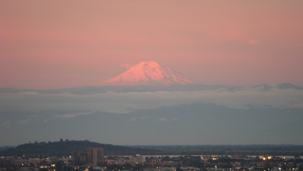
Mount Everest is the highest point on Earth above sea level, but it is not the point farthest from the planet’s center. Because Earth bulges slightly at the equator, Ecuador’s Mount Chimborazo sits more than 2,000 meters farther from Earth’s center than Everest’s summit, even though Chimborazo is much lower above sea level.
In the mood for more?
Check out 20 Real Science Facts That Sound Like Internet Lies, or take a look at 16 Interesting Facts About Our Solar System. If you want to see more surprising geography, you can check out 15 Places on Earth So Extreme They Look Almost Impossible.